
Explore Milwaukee's East Side by bike!
What's a Bike Scramble??
Participants will be provided a list of checkpoints located throughout Milwaukee's East Side. The checkpoint list will include the name of the location, a map link to the location, and a photo of the location. It will be up to the participants to decide the best route between checkpoints, with the ideal route traveling 14 miles. The first rider to reach all the checkpoints wins!
Digital checkpoint system!!
RIDERS WILL NEED A SMART PHONE! There's no way around this one. At race start, riders will receive their official ride e-mail. The email will contain a low detail overview map of all the checkpoints. More importantly, the email will provide riders with a unique link to the ride system which will contain the names of the checkpoints, Google Map "pins" to the checkpoints, and a photo of the exact spot. As you arrive at a checkpoint, the ride system provides participants with an easy way to submit a selfie that includes the location, your bike, and your face!
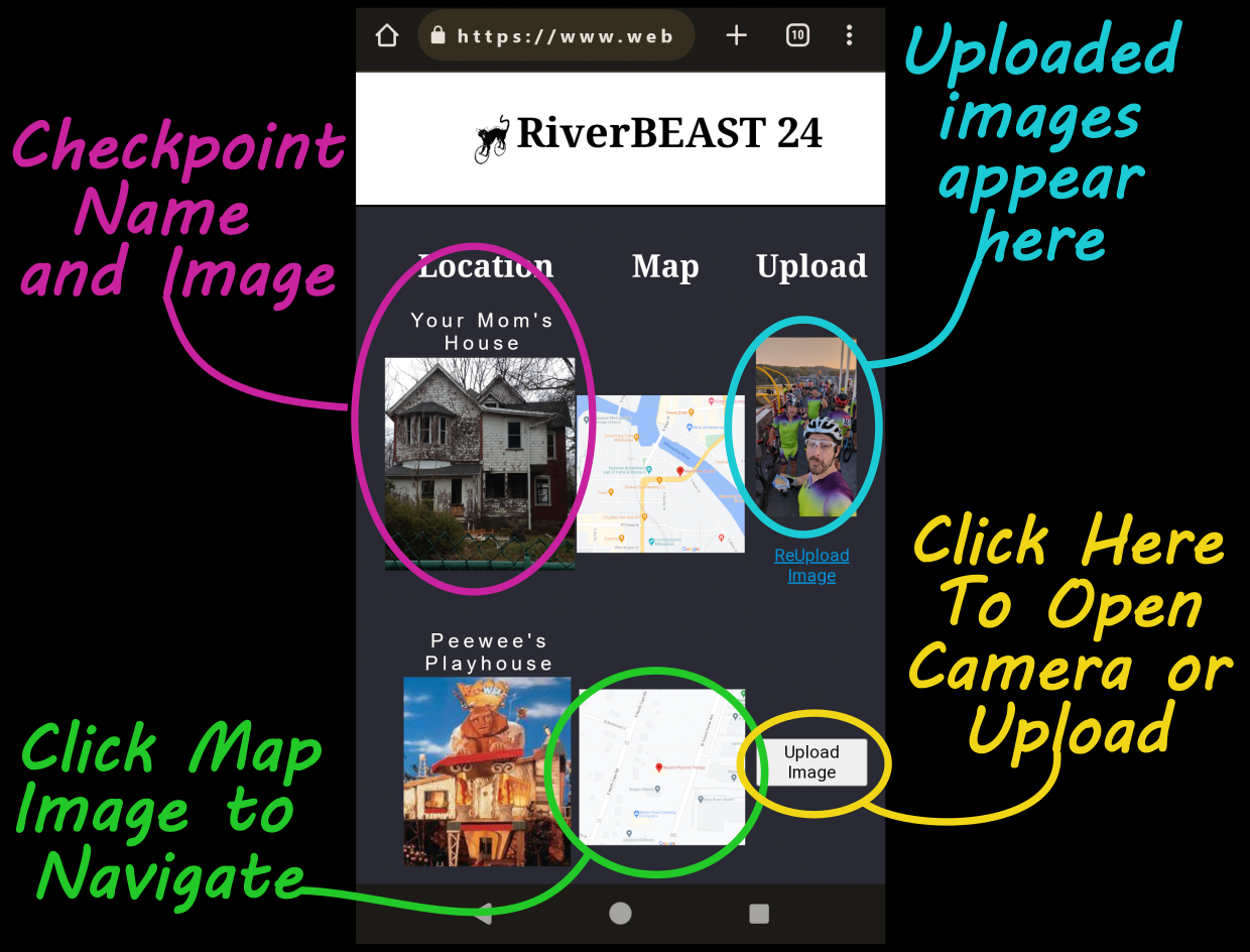
Checkpoint visuals
The ride system includes overview maps and clear checkpoint photos so you can verify you're in the right spot before you snap and submit your selfie.
No app, no tracking
The rider interface runs in your phone's browser. There is no app to install, no cookies, and no trackers. Nothing gets collected while you're not looking.
The only data that exists is what you typed into the registration form. Name, email, phone number. Photos during the ride are optional, and you pick what happens with them when you register.
It gets even crazier!!
Riders are responsible for their own choices while participating in this event. How riders approach each checkpoint is 100% up to them. There's no ride support, no street closures, no aid stations, and no "special considerations" given to participants.
Riders should expect that NOT ALL CHECKPOINTS CAN BE REACHED ON FLAT PAVEMENT. Dirt, grass, sand, and stairs will all likely obstruct a direct route to many checkpoints. It will be up to the rider to decide what is and is not rideable, when to get off and walk, or when to choose another route.
Where is the start and finish?
The 2026 RiverBEAST Ride starts and finishes at Eagle Park Brewing, 823 E Hamilton St, Milwaukee, WI 53202.
How long is the ride?
The optimized route between all checkpoints is a 14 mile ride. Riders should expect the ride to take anywhere between one to two hours, with the ride closing after 3 hours.
Whats the difference between the Competitive, Standard, and E-bike registrations.
There is no price difference between any of the registration types. Competitive registrants are eligible for podium prizes but will not see the overview map on their rider interface. Standard and e-bike riders will see an interactive overview map to help with route planning and navigation.
Do I have to race?
No! There's a registration category for folks that are riding just for the fun of it! Enjoy the ride and everything Milwaukee's East Side has to offer!
Are e-bikes allowed?
Yes! There's a separate race category for e-bikes.